- On sale!


Returns policy

T & Cs
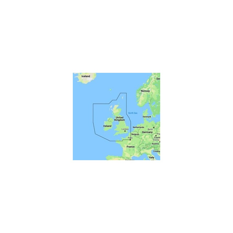
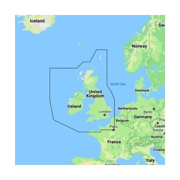
C-Map Discover UK & Ireland Electronic Chart
M-EW-Y200-MS
DISCOVER all you need to make the most of your time on the water. Full-featured Vector Charts with High-Res Bathy, including integrated Genesis® social data, subscription-free Easy Routing™, and Custom Depth Shading.
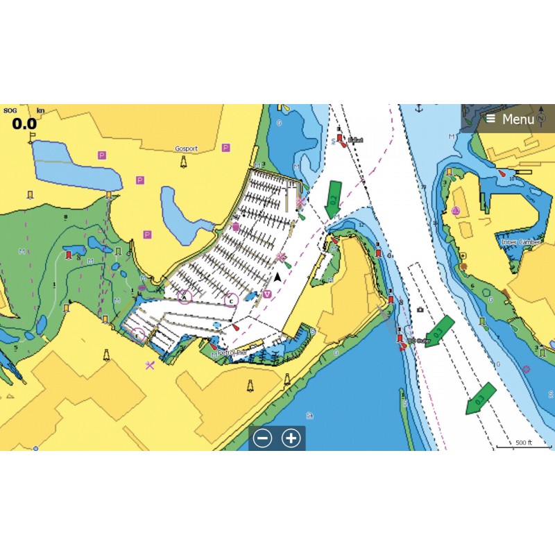
Full-Featured Vector ChartsTides & Currents
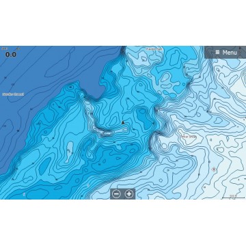
Hi-Res Bathymetry Layer
Detailed Marina Port Plans
Integrated Genesis Layer
Custom Depth Shading
12 Months’ Free Updates
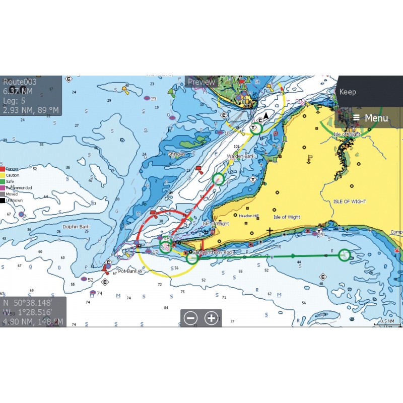
Subscription-Free Easy Routing
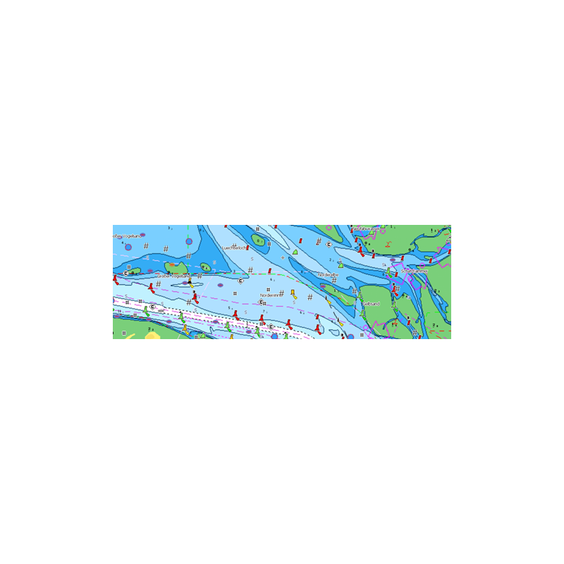
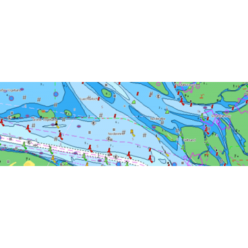
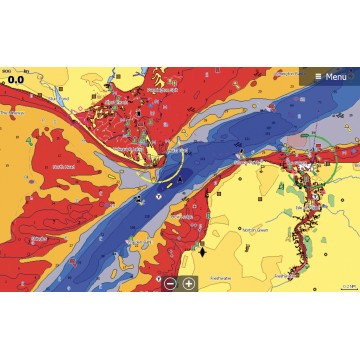
Full-Featured Vector charts make navigation easy by giving you accurate, up-to-date vector chart detail derived from official Hydrographic Office information.
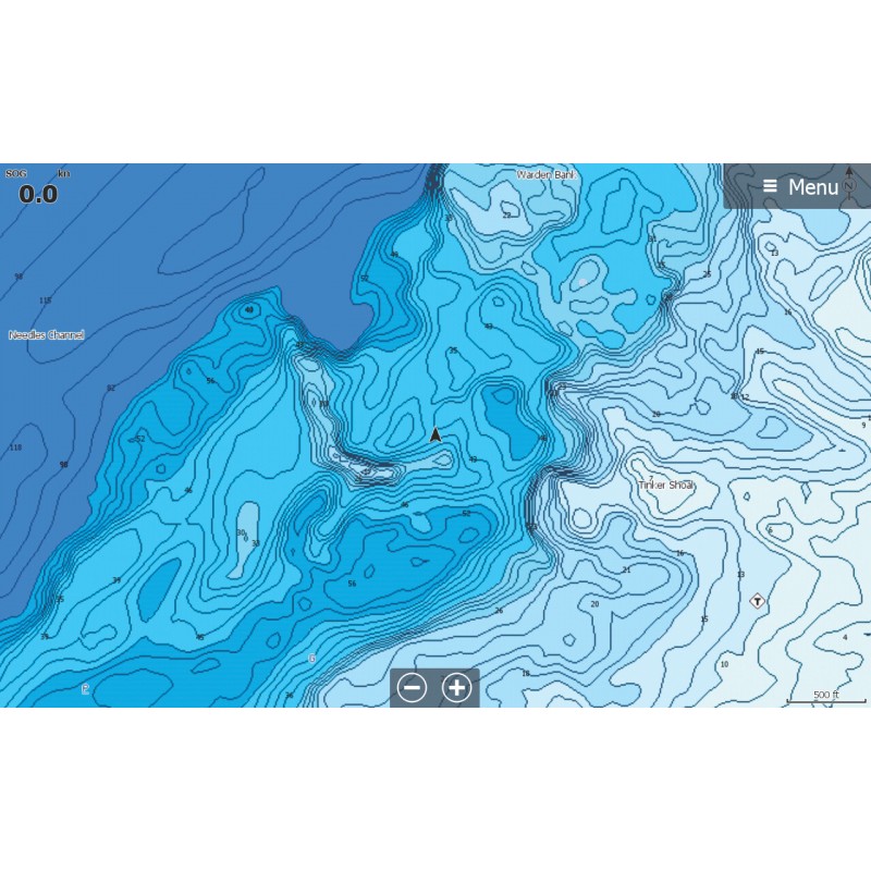
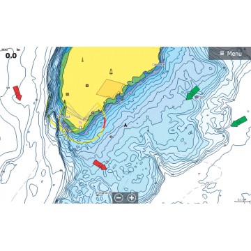
High-Res Bathymetry (HRB) Layer helps you identify shallow areas, drop offs, ledges, holes or humps by accurate contour lines down to 1-foot level of detail. Includes the very best of C-MAP HRB data, including C-MAP Team Lake Surveys (US only) and Genesis® social maps, quality controlled and fully integrated.
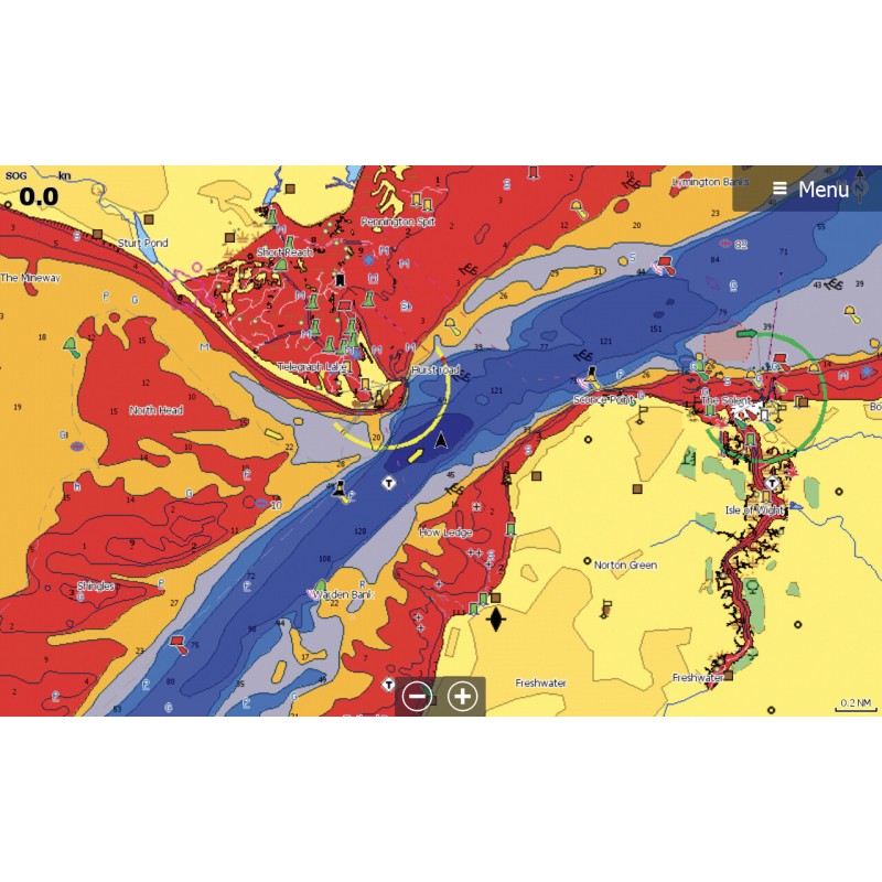
Custom Depth Shading allows you to set a safety depth, maintain a paper-like view or set your own custom shading – see things your way.
Easy Routing helps you automatically plot the shortest, safest route based on detailed chart data and your personalized vessel information. With C-MAP Easy Routing is always subscription free.
Tides & Currents show projections of water level and direction of tides to help plan your day out, whether cruising, angling or sailing.
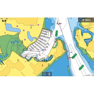
Docking in an unfamiliar port is no problem, when you have precise layouts of thousands of marinas, including slip spaces, restricted areas, and other valuable navigation information.
Supplied on Micro SD Card with Full SD adapter - Please specify the make & model of your plotter when ordering so we can supply the correct format.
This item is Used but is in excellent condition, HEAD UNIT ONLY
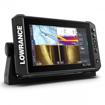
The new Elite Fishing System (FS) gives you access to the full line-up of Lowrance fishfinding tools – including ActiveTarget™ live sonar, Active Imaging™ and compatibility with a wide range of chart options – to help you make the most of your time on the water.